Google Groundsource Uses Gemini to Predict Flash Floods 24 Hours in Advance

Google Turned Decades of Flood Reports Into an AI That Predicts Disasters
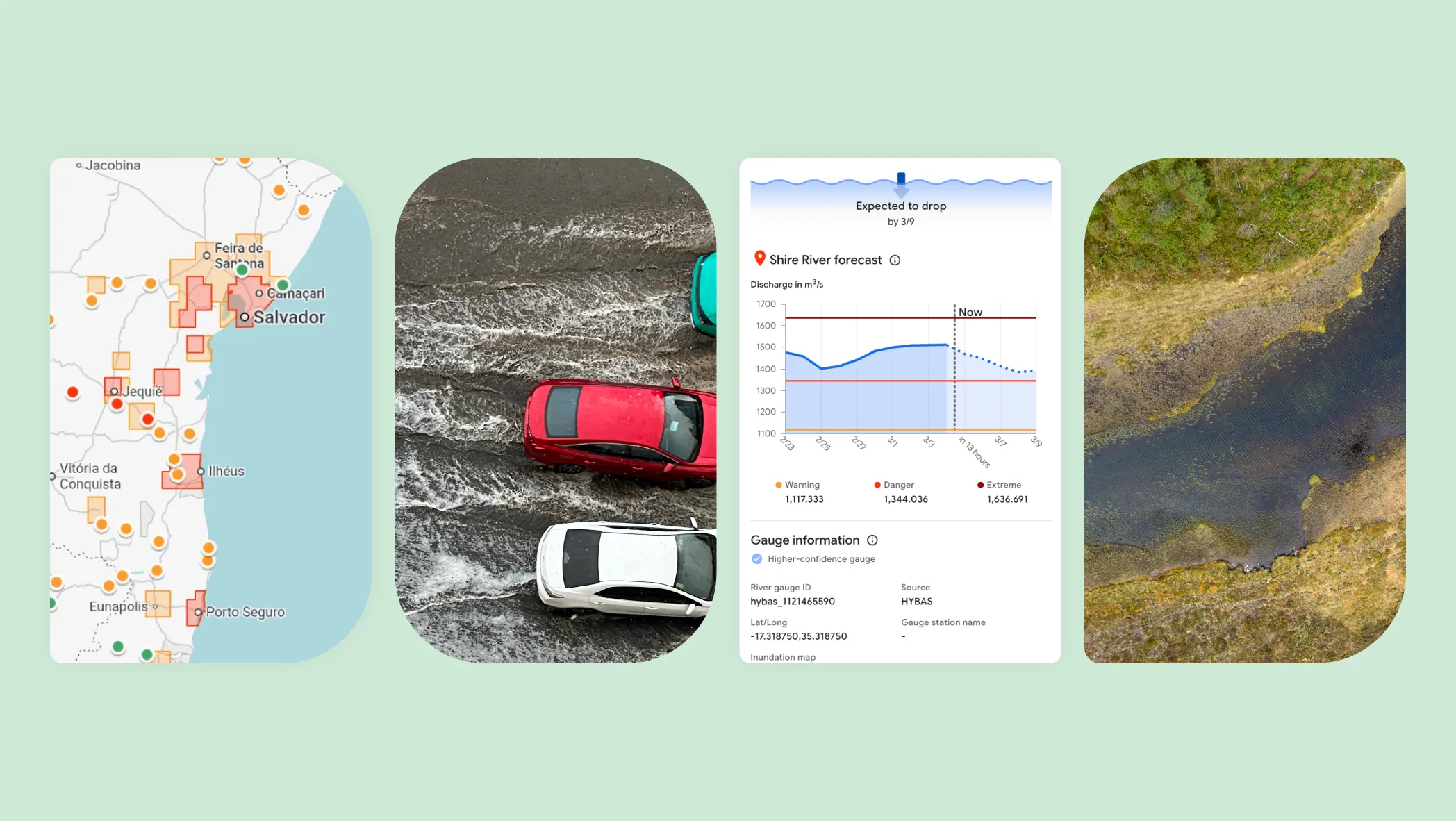
Google has introduced Groundsource, a new AI methodology that transforms decades of public disaster reports into a structured, high-quality dataset — and then uses that data to predict urban flash floods up to 24 hours in advance. The system is powered by Gemini, Google’s most capable AI model, and has already identified over 2.6 million historical flood events across more than 150 countries.
The flash flood forecasts are now available in Google’s Flood Hub, joining existing riverine flood predictions that already cover 2 billion people globally. This is a significant expansion: urban flash floods are fundamentally different from river flooding and have historically lacked the data needed for accurate prediction.
The Data Gap Problem
River floods follow predictable patterns — rivers rise, gauges measure water levels, models forecast downstream impact. Flash floods in urban areas do not work that way. They happen suddenly, in locations without dedicated monitoring infrastructure, and historical records are scattered across local news reports, government filings, and social media posts.
This data gap has prevented AI models from learning to predict urban flash floods. You cannot train a prediction model without historical examples to learn from. Groundsource solves this by using Gemini to analyze decades of unstructured public reports — news articles, government records, community reports — and extract structured flood event data from them. Google Maps then provides precise geographic boundaries for each event.
How Groundsource Works
The process has three steps:
- Data extraction: Gemini reads and analyzes millions of public documents, identifying references to flood events and extracting key details (location, timing, severity)
- Geographic precision: Google Maps determines exact geographic boundaries for each identified flood event, turning vague location references into precise coordinates
- Model training: The resulting dataset of 2.6 million events is used to train a prediction model focused specifically on urban flash flooding
The result is a model that can forecast flash floods in urban areas up to 24 hours before they happen — enough time for emergency services to prepare and for residents to take action.
The Skeptical Take
Groundsource is genuinely impressive as a data engineering achievement. Using an LLM to extract structured data from millions of unstructured documents is exactly the kind of problem that Gemini should be solving. And the 2.6 million events across 150+ countries represents a dataset that simply did not exist before.
But there are important caveats. First, the accuracy of the predictions depends entirely on the quality of the training data — and Gemini’s ability to correctly interpret decades of reports in dozens of languages is far from guaranteed. Second, a 24-hour warning for flash floods is useful but not revolutionary — weather services already provide flood watches. The real question is whether Groundsource’s predictions are meaningfully more accurate or localized than existing systems.
Google making the dataset open-source is a strong move. It allows independent researchers to validate and improve the predictions rather than relying solely on Google’s claims about accuracy.
The Bottom Line
Groundsource represents a clever application of Gemini: turning unstructured public data into a prediction engine for a disaster type that previously lacked the historical data for AI modeling. The 2.6 million flood events and 150+ country coverage are genuinely new. Whether the predictions are accurate enough to save lives will depend on real-world validation that has not happened yet — but the open-source dataset means that validation can happen independently.